President Barack Obama, acting as his time in office winds down to further his noteworthy record of advancing public land conservation, moved Thursday to enlarge two existing national monuments in the West and established three national monuments in the South to recognize the long struggle for racial equality in the United States.
Obama adjusted the boundaries of California Coastal National Monument in California and Cascade-Siskiyou National Monument in southern Oregon and northern California. Both national monuments are on land managed by the Bureau of Land Management, an agency of the U.S. Department of Interior.
“The BLM manages some of the nation’s wildest and most sacred landscapes, including more than 800 areas that have been protected through congressional and presidential action,” Neil Kornze, the director of BLM, said. “We’re proud to be charged with stewarding these incredible lands for future generations, including today’s additions to the Cascade-Siskiyou National Monument and the California Coastal National Monument. The BLM looks forward to continuing and expanding our work with local communities to ensure successful management of these special places.”

-
California Coastal National Monument. Image courtesy BLM, photo by Bob Wick.
Obama’s proclamation expanding California Coastal National Monument tracked the language of the American Antiquities Act of 1906 and pointed to the “historic or scientific interest” of six areas that will now be included in it: Trinidad Head, Waluplh-Lighthouse Ranch, Lost Coast Headlands, Cotoni-Coast Dairies, Piedras Blancas, and Orange County Rocks and Islands. The first three of those listed sites are in Humboldt County, the core of the Golden State’s “Redwood Coast,” while the others are located, respectively, in Santa Cruz County, San Luis Obispo County, and Orange County.

-
Trinidad Head appears on the upper right of this photograph. Image courtesy Wikimedia, photo by TrinidadMike.
Trinidad Head, in Humboldt County, is a high promontory known as the site where Spanish explorers landed in June 1775 to claim the land now known as California for King Charles III. Portuguese sailors had discovered the site even earlier, in 1595.
The site has been the location of a picturesque lighthouse since 1871 and now also serves as location for scientific research. The National Oceanic & Atmospheric Administration established a meteorological laboratory there in 2002, while NASA has studied trace atmospheric gases from the location since 1995. Thirteen acres of the site are now included within the boundaries of California Coastal National Monument.
Waluplh-Lighthouse Ranch is 12 miles south of Eureka. A property of high ancestral significance to the Wyot Tribe, it was used by the U.S. Coast Guard beginning in the late 1800s. The military developed a base for coastal lookout operations there during the 1940s, but now there are no buildings on the site. Visitors to the property can see the Pacific Ocean, Eel River Delta, and south spit of Humboldt Bay.

-
This photo shows some of the remote Lost Coast Headlands in central California. Image courtesy BLM, photo by Bob Wick.
The Lost Coast Headlands are located 13 miles south of Waluph-Lighthouse Ranch. They are of geological value because the sedimentary rock underneath the hills, bluffs, and forests include marine fossils dating from Pleistocene Epoch. The areas’s biodiversity includes bobcats, gray fox, and mountain lions, as well as a variety of raptors, a steelhead run, and a population of threatened California red-legged frogs.
Named for an area bypassed by U.S. Highway 1, the Lost Coast area of which the headlands are part lost population beginning in the 1930s. The nearby Sinkyone Wilderness State Park and King Range National Conservation Area also aim to preserve the scenic region, known for its black sand beaches, spectacular vistas and tall redwood trees.

-
This photo provides a view of the coastal lands of the Cotoni-Coast Dairies property now included within California Coastal National Monument. Image courtesy Wikimedia.
Most of the land known as Santa Cruz County’s Cotoni-Coast Dairies are not now open to the public. The 5,785-acre property was obtained by The Trust for Public Land in 1998. That organization then donated 407 acres to California State Parks and most of the rest to BLM in 2014.
The Cotoni-Coast Diaries property spans six watersheds, all of which are considered to be viable Pacific salmon habitat. Three of the streams on the property – Laguna Creek, Liddell Creek, and San Vicente Creek – actually host salmon or steelhead spawners. The mammal population is also diverse. As described in Obama’s proclamation:
“The diversity of the uplands vegetation in Cotoni-Coast Dairies supports a rich wildlife community including a vast and varied mammalian population. Among the many species inhabiting Cotoni-Coast Dairies are California voles, dusky-footed woodrats, black-tailed jackrabbits, mule deer, and gray fox. Evidence also suggests that both bobcats and mountain lions hunt here.
“Visitors to Cotoni-Coast Dairies may be able to catch a glimpse of a variety of avian species, including black swifts, orange crowned warblers, American kestrels, Cooper’s hawks, white-tailed kites, and peregrine falcons. In the riparian areas, one may encounter Wilson’s warblers, downy woodpeckers, and tree swallows, among others. Various bat species, including the Townsend’s big-eared bat, can be seen darting overhead at dusk.”
The land given by The Trust for Public Land to California was later opened to the public as Coast Dairies State Park.
-

-
Elephant seals rest on the beach at Piedras Blancas. Image courtesy Scripps Institute of Oceanography, photo by Wolf Berger.
Piedras Blancas, about 40 miles north of San Luis Obispo, is known for its elephant seal rookery and its historic lighthouse. The site has long been important to native Americans because, for at least 3,000 years, it was a location for trading between different cultures. The explorer Juan Rodriguez Cabrillo claimed it for Spain in 1542 and, three-plus centuries later, a lighthouse was built there in the 1870s.
Elephant seals are not the only pinniped visitors to Piedras Blancas. California sea lions and harbor seals are also common there. Whales and dolphins can be seen from the beaches. The region also serves as habitat for a variety of birds, amphibians, and reptiles and boasts a broad array of plants, including at least 70 native species.
The sixth area included in Obama’s expansion of California Coastal National Monument is in southern California. The Orange County Rocks and Islands are important habitat for a variety of sea birds, including the formerly endangered brown pelican (Pelecanus occidentalis), and marine mammals. They also provide a unique view of coastal geology for visitors to the coast.
Designated by Congress during the 1930s as sites for lighthouses, the Orange County Rocks and Islands were the only offshore California lands that had not previously been included in the California Coastal National Monument.
California Coastal National Monument was established in 2000 by President William Jefferson Clinton. Clinton’s proclamation emphasized that his decision to create the preserve was motivated principally by a desire to protect marine wildlife habitat.
Obama expanded the monument in March 2014 to include the Point Arena-Stornetta Public Lands, a scenic coastal area in Mendocino County that includes dunes, prairies, riverbanks, shelves, tidepools, and the mouth of the Garcia River.
-
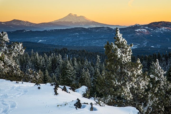
Cascade-Siskiyou National Monument. Image courtesy BLM.
Obama’s other national monument expansion announced Thursday impacts another Clinton-era designation. The Cascade-Siskiyou National Monument, first set aside in 2000, is now about 48,000 acres larger.
Focusing on the region’s significance to an array of wildlife, Obama’s Jan. 12 proclamation explained that the uniquely abundant biodiversity in the Cascade-Siskiyou region provided a convincing reason for the expansion:
“Cascade-Siskiyou’s biodiversity, which provides habitat for a dazzling array of species, is internationally recognized and has been studied extensively by ecologists, evolutionary biologists, botanists, entomologists, and wildlife biologists. Ranging from high slopes of Shasta red fir to lower elevations with Douglas fir, ponderosa pine, incense cedar, and oak savannas, the topography and elevation gradient of the area has helped create stunningly diverse ecosystems. From ancient and mixed-aged conifer and hardwood forests to chaparral, oak woodlands, wet meadows, shrublands, fens, and open native perennial grasslands, the landscape harbors extraordinarily varied and diverse plant communities. Among these are threatened and endangered plant species and habitat for numerous other rare and endemic species.”
The President also highlighted the imperative of providing space for animal populations to move, specifically mentioning the major features that will now be included in the national monument: Horseshoe Ranch, the Jenny Creek watershed, the Grizzly Peak area, Lost Lake, the Rogue Valley foothills, the Southern Cascades area, and the area surrounding Surveyor Mountain.
Among the many species found in this area are hundreds of flowering plants, several ferns, and at least six trees. Obama also cited the presence of 14 raptors, including the threatened northern spotted owl, a large variety of songbirds and avians dependent on marshes and other freshwater resources, and a long list of amphibians, fish, invertebrates, mammals, and reptiles.
Obama also noted the region’s significance to native Americans and as a path for the Applegate Trail.
The two western national monument expansions were not Thursday’s only invocations of the Antiquities Act of 1906. Obama also set aside three small national monuments in the south.
Each is aimed at commemorating the sites of important events in the nation’s long quest for equal justice and equal rights and all three will be managed by the National Park Service.

-
This photo shows the Freedom Riders bus in flames following an attack on African-Americans working to secure their Constitutional rights. Image courtesy National Park Service.
The Birmingham Civil Rights National Monument, in Birmingham, Ala., and the Freedom Riders National Monument, in Anniston, Ala., pay homage to the Civil Rights movement of the 1960s, while Reconstruction Era National Monument in becomes the only component of the National Park System that aims to build public awareness of the post-Civil War era in which the federal government worked to integrate freed slaves into the national political and economic fabric.
“African-American history is American history and these monuments are testament to the people and places on the front-lines of our entire nation’s march toward a more perfect union,” U.S. secretary of interior Sally Jewell said. “Now the National Park Service, America’s Storyteller, will forever be responsible for safeguarding the narrative of not only the sparks that ignited the Civil Rights movement but also the hope of the Reconstruction Era, which for far too long, has been neglected from our national conscience.”
With Thursday’s announcements Obama became the most prolific land and water conservationist of all American chief executives. He has designated or increased the size of 34 national monuments during his eight-year tenure, two more than President Franklin Delano Roosevelt.
The total amount of acreage, including both land and ocean-based national monuments, that Obama has preserved is in excess of 550 million acres.
